File:The Regions of Elondor.jpg
Revision as of 10:11, 6 August 2022 by Michaelmgoessler (talk | contribs)

Size of this preview: 800 × 566 pixels. Other resolutions: 320 × 226 pixels | 640 × 453 pixels | 1,024 × 724 pixels | 1,280 × 905 pixels | 2,560 × 1,810 pixels | 14,032 × 9,922 pixels.
Original file (14,032 × 9,922 pixels, file size: 29.27 MB, MIME type: image/jpeg)
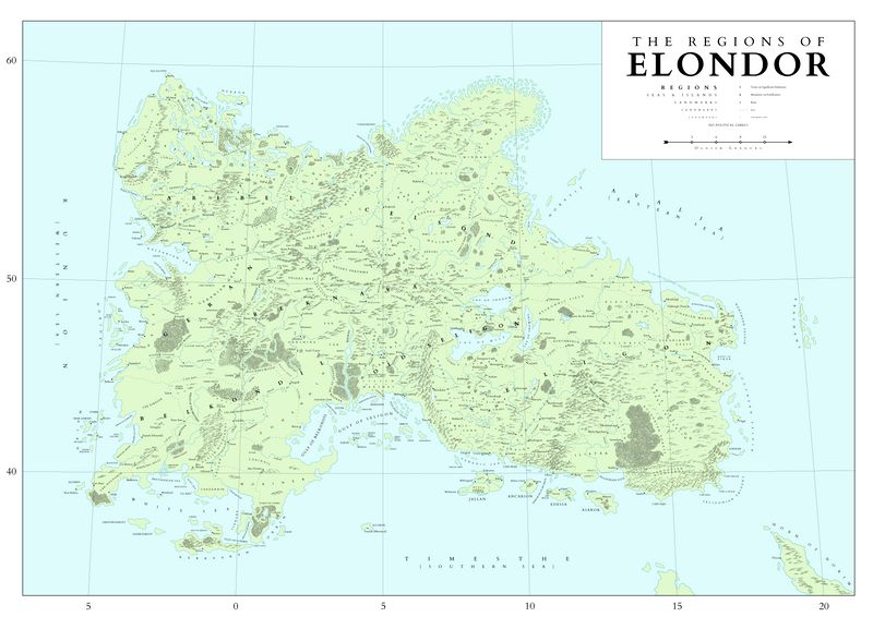
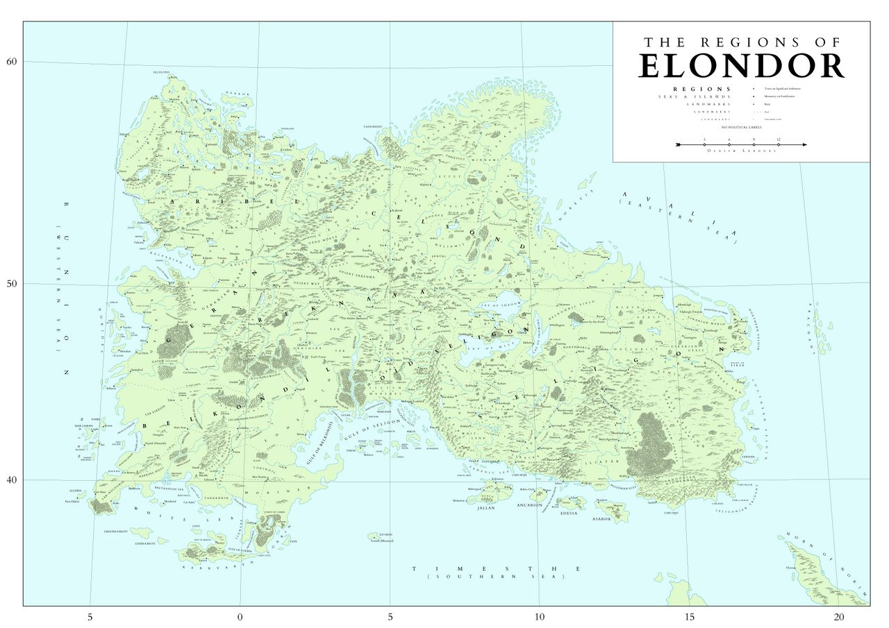
Map of Elondor around 700 L.R. showing major regions, landscapes, and settlements. No political labels.
File history
Click on a date/time to view the file as it appeared at that time.
| Date/Time | Thumbnail | Dimensions | User | Comment | |
|---|---|---|---|---|---|
| current | 11:01, 6 August 2022 | | 14,032 × 9,922 (29.27 MB) | Michaelmgoessler (talk | contribs) | Corrected miscapitalization of the River Dôkob label |
| 10:11, 6 August 2022 |  | 14,032 × 9,922 (29.28 MB) | Michaelmgoessler (talk | contribs) |
You cannot overwrite this file.
File usage
The following page uses this file: